Florida Memory is administered by the Florida Department of State, Division of Library and Information Services, Bureau of Archives and Records Management. The digitized records on Florida Memory come from the collections of the State Archives of Florida and the special collections of the State Library of Florida.

State Archives of Florida
- ArchivesFlorida.com
- State Archives Online Catalog
- ArchivesFlorida.com
- ArchivesFlorida.com
State Library of Florida
Related Sites
Description of previous item
Description of next item

Source
Description
Date
Creator
Format
Coverage
Topic
Subjects
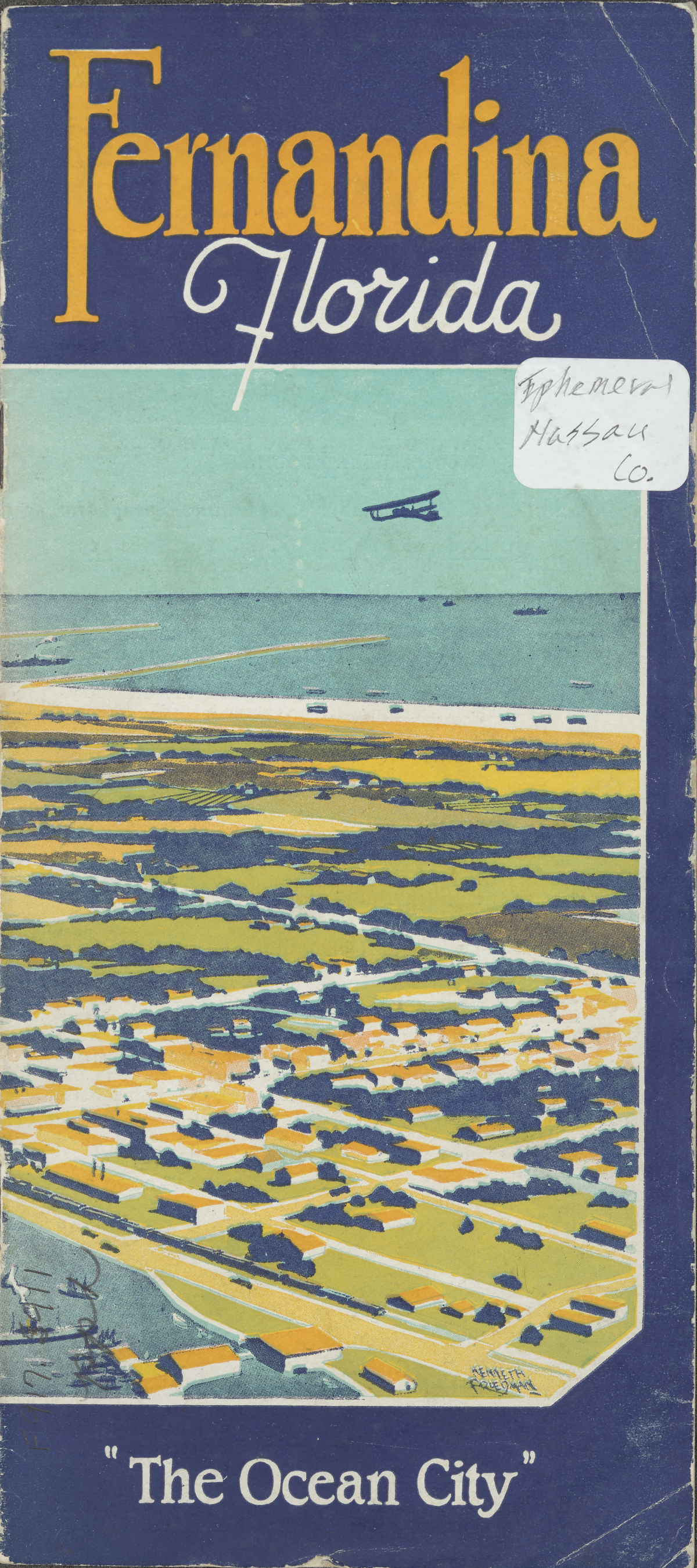
Fernandina Florida "The Ocean CIty"
[Drawing of an aerial view of Fernandina]
Title
Subject
Description
Creator
Source
Date
Contributor
Format
Language
Type
Identifier
Coverage
Geographic Term
Thumbnail
ImageID
topic
Subject - Corporate
Transcript
Fernandina Florida "The Ocean CIty"
[Drawing of an aerial view of Fernandina]
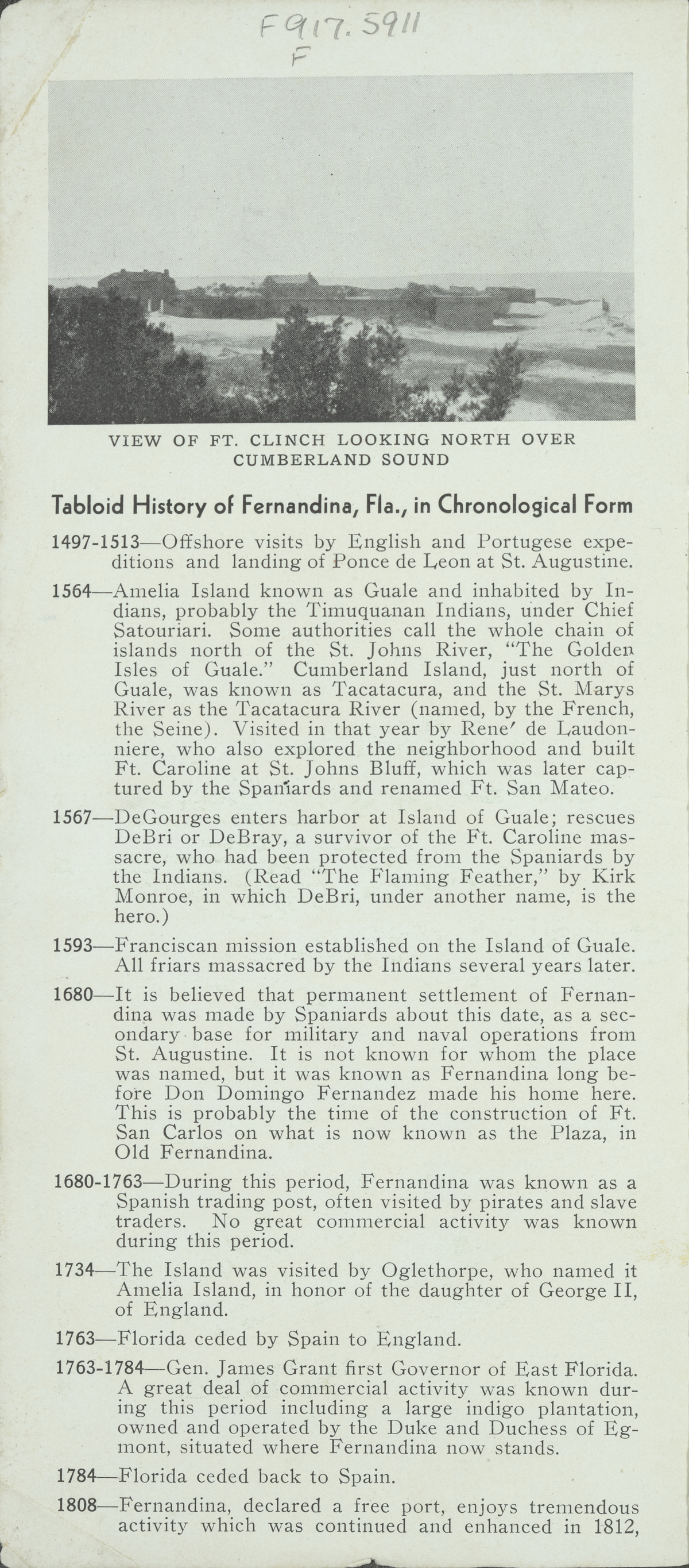
[Photograph of View of Ft. Clinch Looking North Over Cumberland Sound]
Tabloid History of Fernandina, Fla., in Chronological Form
1497-1513—Offshore visits by English and Portugese expeditions and landing of Ponce de Leon at St. Augustine. :
1564—Amelia Island known as Guale and inhabited by Indians, probably the Timuquanan Indians, under Chief Satouriari. Some authorities call the whole chain of islands north of the St. Johns River, “The Golden Isles of Guale.” Cumberland Island, just north of Guale, was known as Tacatacura, and the St. Marys River as the Tacatacura River (named, by the French, the Seine). Visited in that year by Rene’ de Laudonniere, who also explored the neighborhood and built Ft. Caroline at St. Johns Bluff, which was later captured by the Spaniards and renamed Ft. San Mateo.
1567—DeGourges enters harbor at Island of Guale; rescues DeBri or DeBray, a survivor of the Ft. Caroline massacre, who had been protected from the Spaniards by the Indians. (Read “The Flaming Feather,’ by Kirk Monroe, in which DeBri, under another name, is the hero.)
1593—Franciscan mission established on the Island of Guale. All friars massacred by the Indians several years later.
1680—It is believed that permanent settlement of Fernandina was made by Spaniards about this date, as a secondary base for military and naval operations from
St. Augustine. It is not known for whom the place was named, but it was known as Fernandina long before Don Domingo Fernandez made his home here. This is probably the time of the construction of Ft.
San Carlos on what is now known as the Plaza, in Old Fernandina.
1680-1763—During this period, Fernandina was known as a Spanish trading post, often visited by pirates and slave
traders. No great commercial activity was known during this period.
1734—The Island was visited by Oglethorpe, who named it Amelia Island, in honor of the daughter of George II, of England.
1763—Florida ceded by Spain to England.
1763-1784—Gen. James Grant first Governor of East Florida. A great deal of commercial activity was known during this period including a large indigo plantation, owned and operated by the Duke and Duchess of Egmont, situated where Fernandina now stands.
1784—Florida ceded back to Spain.
1808— Fernandina, declared a free port, enjoys tremendous activity which was continued and enhanced in 1812,
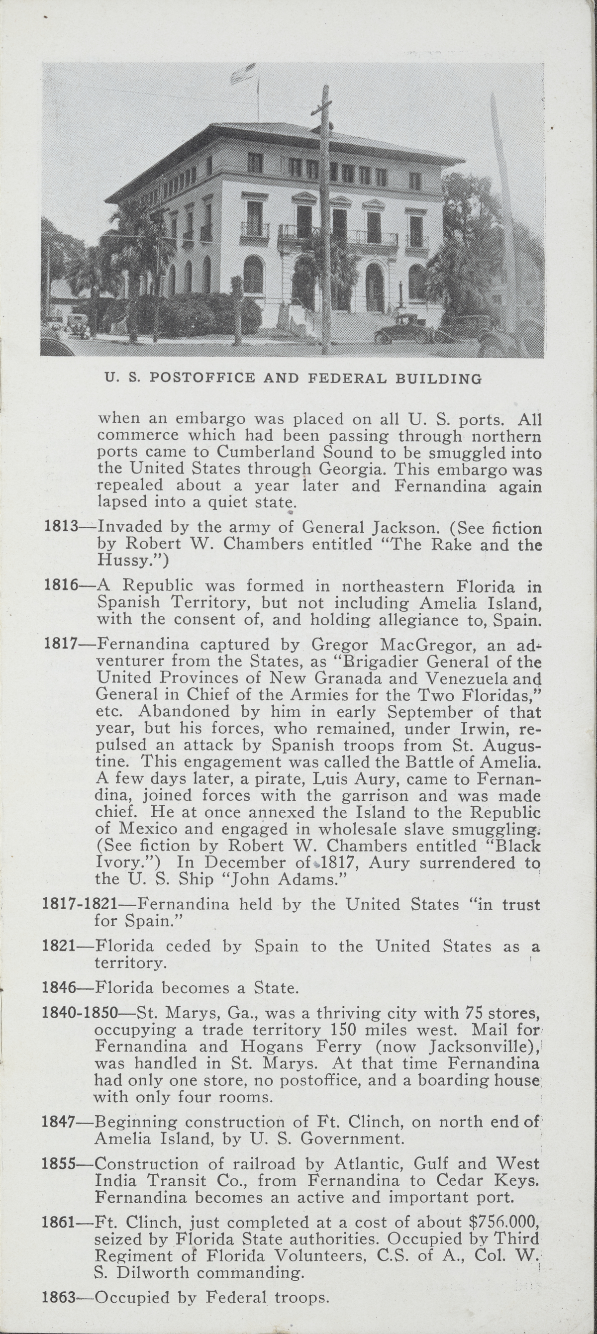
[Photograph of the U. S. Postoffice and Federal Building]
when an embargo was placed on all U. S. ports. All commerce which had been passing through northern ports came to Cumberland Sound to be smuggled into the United States through Georgia. This embargo was repealed about a year later and Fernandina again lapsed into a quiet state.
1813—Invaded by the army of General Jackson. (See fiction by Robert W. Chambers entitled “The Rake and the
Hussy.”’)
1816—A Republic was formed in northeastern Florida in Spanish Territory, but not including Amelia Island, with the consent of, and holding allegiance to, Spain.
1817—-Fernandina captured by Gregor MacGregor, an adventurer from the States, as “Brigadier General of the United Provinces of New Granada and Venezuela and General in Chief of the Armies for the Two Floridas,” etc. Abandoned by him in early September of that year, but his forces, who remained, under Irwin, repulsed an attack by Spanish troops from St. Augustine. This engagement was called the Battle of Amelia. A few days later, a pirate, Luis Aury, came to Fernandina, joined forces with the garrison and was made chief. He at once annexed the Island to the Republic of Mexico and engaged in wholesale slave smuggling. (See fiction by Robert W. Chambers entitled “Black
Ivory.”) In December of 1817, Aury surrendered to the U. S. Ship “John Adams.”
1817-1821—-Fernandina held by the United States “in trust
for Spain.”
1821—-Florida ceded by Spain to the United States as a
territory.
1846—Florida becomes a State.
1840-1850—St. Marys, Ga., was a thriving city with 75 stores, occupying a trade territory 150 miles west. Mail for Fernandina and Hogans Ferry (now Jacksonville), was handled in St. Marys. At that time Fernandina had only one store, no postoffice, and a boarding house with only four rooms.
1847—Beginning construction of Ft. Clinch, on north end of Amelia Island, by U. S. Government. :
1855—Construction of railroad by Atlantic, Gulf and West India Transit Co., from Fernandina to Cedar Keys. Fernandina becomes an active and important port.
1861—Ft. Clinch, just completed at a cost of about $756.000, seized by Florida State authorities. Occupied by Third Regiment of Florida Volunteers, C.S. of A., Col. W. S. Dilworth commanding.
1863—Occupied by Federal troops.
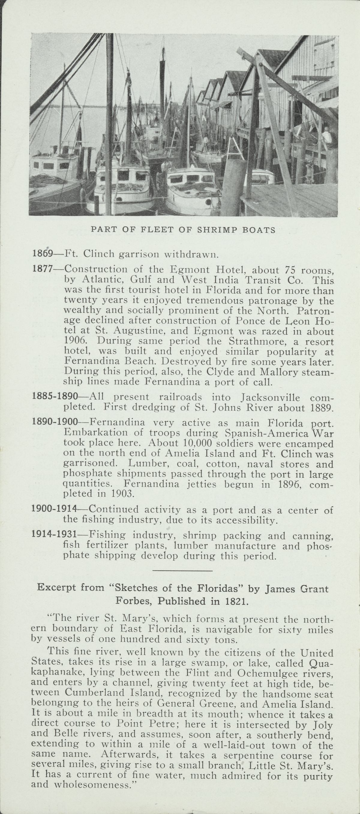
{Photograph of Part of Fleet of Shrimp Boats]
1869—Ft. Clinch garrison withdrawn.
1877—Construction of the Egmont Hotel, about 75 rooms, by Atlantic, Gulf and West India Transit Co. This was the first tourist hotel in Florida and for more than twenty years it enjoyed tremendous patronage by the wealthy and socially prominent of the North. Patronage declined after construction of Ponce de Leon Hotel at St. Augustine, and Egmont was razed in about
1906. During same period the Strathmore, a resort hotel, was built and enjoyed similar popularity at Fernandina Beach. Destroyed by fire some years later. During this period, also, the Clyde and Mallory steamship lines made Fernandina a port of call.
1885-1890—All present railroads into Jacksonville completed. First dredging of St. Johns River about 1889.
1890-1900—Fernandina very active as main Florida port. Embarkation of troops during Spanish-America War took place here. About 10,000 soldiers were encamped on the north end of Amelia Island and Ft. Clinch was garrisoned. Lumber, coal, cotton, naval stores and phosphate shipments passed through the port in large quantities. Fernandina jetties begun in 1896, completed in 1903.
1900-1914—-Continued activity as a port and as a center of the fishing industry, due to its accessibility.
1914-1931—Fishing industry, shrimp packing and canning, fish fertilizer plants, lumber manufacture and phosphate shipping develop during this period.
Excerpt from “Sketches of the Floridas” by James Grant Forbes, Published in 1821.
“The river St. Mary’s, which forms at present the northern boundary of East Florida, is navigable for sixty miles by vessels of one hundred and sixty tons. This fine river, well known by the citizens of the United States, takes its rise in a large swamp, or lake, called Quakaphanake, lying between the Flint and Ochemulgee rivers, and enters by a channel, giving twenty feet at high tide, between Cumberland Island, recognized by the handsome seat belonging to the heirs of General Greene, and Amelia Island. It is about a mile in breadth at its mouth: whence it takes a direct course to Point Petre; here it is intersected by Joly and Belle rivers, and assumes, soon after, a southerly bend, extending to within a mile of a well-laid-out town of the same name. Afterwards, it takes a serpentine course for several miles, giving rise to a sinall branch, Little St. Mary’s. It has a current of fine water, much admired for its purity and wholesomeness.”
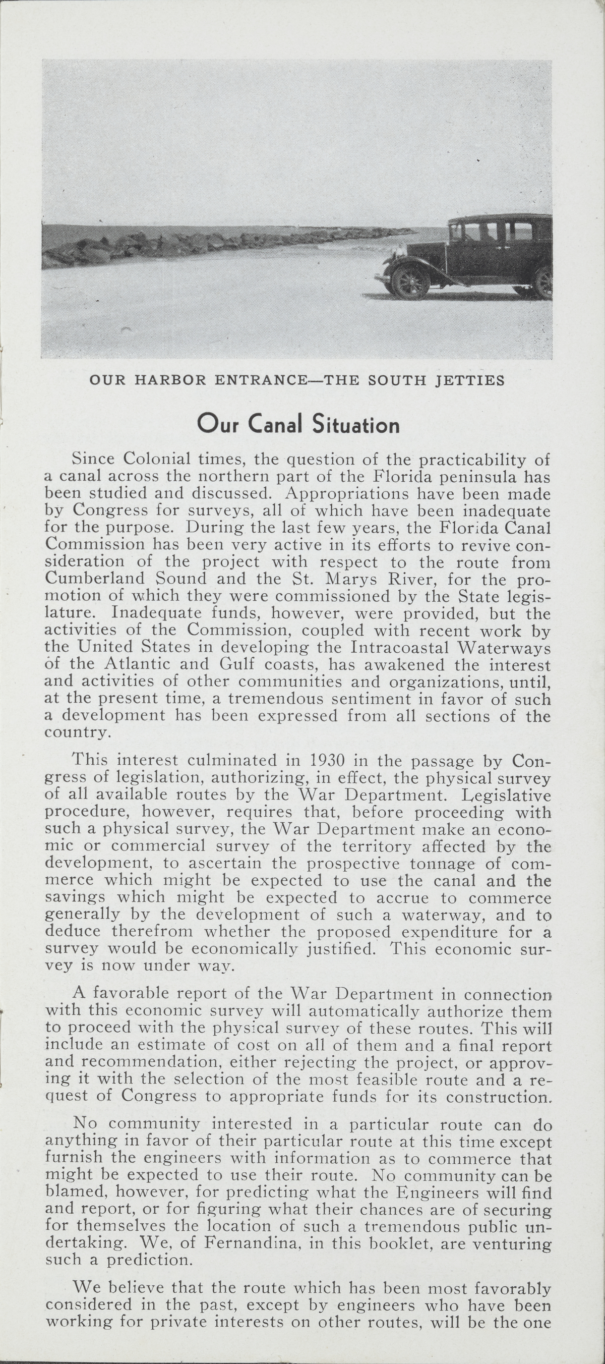
[Photograph of Our Harbor Entrance- The South Jetties]
Our Canal Situation
Since Colonial times, the question of the practicability of a canal across the northern part of the Florida peninsula has been studied and discussed. Appropriations have been made by Congress for surveys, all of which have been inadequate for the purpose. During the last few years, the Florida Canal Commission has been very active in its efforts to revive consideration of the project with respect to the route from Cumberland Sound and the St. Marys River, for the promotion of which they were commissioned by the State legislature. Inadequate funds, however, were provided, but the activities of the Commission, coupled with recent work by the United States in developing the Intracoastal Waterways of the Atlantic and Gulf coasts, has awakened the interest and activities of other communities and organizations, until, at the present time, a tremendous sentiment in favor of such a development has been expressed from all sections of the country.
This interest culminated in 1930 in the passage by Congress of legislation, authorizing, in effect, the physical survey of all available routes by the War Department. Legislative procedure, however, requires that, before proceeding with
such a physical survey, the War Department make an economic or commercial survey of the territory affected by the development, to ascertain the prospective tonnage of commerce which might be expected to use the canal and the savings which might be expected to accrue to commerce generally by the development of such a waterway, and to deduce therefrom whether the proposed expenditure for a survey would be economically justified. This economic survey is now under way.
A favorable report of the War Department in connection with this economic survey will automatically authorize them to proceed with the physical survey of these routes. This will include an estimate of cost on all of them and a final report and recommendation, either rejecting the project, or approving it with the selection of the most feasible route and a request of Congress to appropriate funds for its construction.
No community interested in a particular route can do anything in favor of their particular route at this time except furnish the engineers with information as to commerce that might be expected to use their route. No community can be blamed, however, for predicting what the Engineers will find and report, or for figuring what their chances are of securing for themselves the location of such a tremendous public undertaking. We, of Fernandina, in this booklet, are venturing such a prediction. :
We believe that the route which has been most favorably considered in the past, except by engineers who have been working for private interests on other routes, will be the one
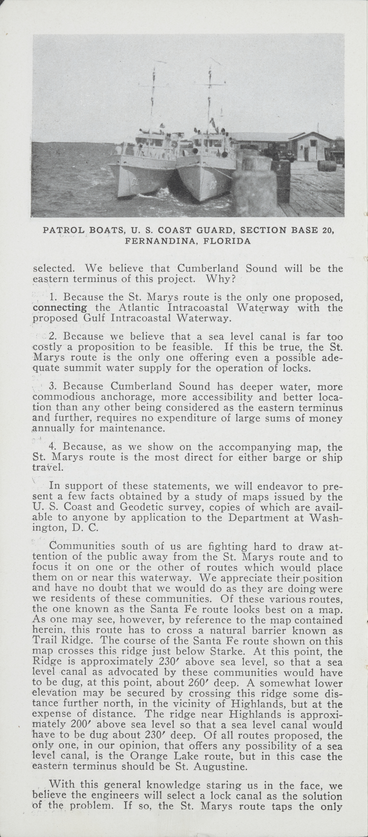
[Photograph of Patrol Boars, U. S. Coast Guard, Section Base 20, Fernandina, Florida]
selected. We believe that Cumberland Sound will be the eastern terminus of this project. Why?
1. Because the St. Marys route is the only one proposed, connecting the Atlantic Intracoastal Waterway with the proposed Gulf Intracoastal Waterway.
2. Because we believe that a sea level canal is far too costly a proposition to be feasible. If this be true, the St. Marys route is the only one offering even a possible adequate summit water supply for the operation of locks.
3. Because Cumberland Sound has deeper water, more commodious anchorage, more accessibility and better location than any other being considered as the eastern terminus and further, requires no expenditure of large sums of money annually for maintenance.
4. Because, as we show on the accompanying map, the St. Marys route is the most direct for either barge or ship
travel.
In support of these statements, we will endeavor to present a few facts obtained by a study of maps issued by the U. S. Coast and Geodetic survey, copies of which are available to anyone by application to the Department at Washington, D. C.
Communities south of us are fighting hard to draw attention of the public away from the St. Marys route and to focus it on one or the other of routes which would place them on or near this waterway. We appreciate their position and have no doubt that we would do as they are doing were we residents of these communities. Of these various routes, the one known as the Santa Fe route looks best on a map. As one may see, however, by reference to the map contained herein, this route has to cross a natural barrier known as Trail Ridge. The course of the Santa Fe route shown on this map crosses this ridge just below Starke. At this point, the Ridge is approximately 230’ above sea level, so that a sea. level canal as advocated by these communities would have to be dug, at this point, about 260’ deep. A somewhat lower elevation may be secured by crossing this ridge some distance further north, in the vicinity of Highlands, but at the expense of distance. The ridge near Highlands is approximately 200’ above sea level so that a sea level canal would have to be dug about 230’ deep. Of all routes proposed, the only one, in our opinion, that offers any possibility of a sea level canal, is the Orange Lake route, but in this case the eastern terminus should be St. Augustine.
With this general knowledge staring us in the face, we believe the engineers will select a lock canal as the solution
of the problem. If so, the St. Marys route taps the only
[Photograph of the City Park]
summit water supply that promises to be adequate for the operation of locks, whether it be for a ship or barge canal. The Okefenokee Swamp is a vast natural reservoir for a drainage area of about 1600 square miles. It is the source of major water supply for two large rivers, the St. Marys and the Suwanee. The surface of this swamp is about 120' above sea level and the greatest elevation the canal would have to cross is the summit of Trail Ridge opposite this swamp, which is only about 150’ above sea level at the point of crossing, at the same time being comparatively narrow, i.e., about two or three miles.
We are, as Floridians, thoroughly in accord with the policy of other Florida cities to promote the full development of all Florida waterways. We are also as selfish as other communities in wishing to secure this major development for ourselves. We feel, however, as a matter of community honor, that the matter of selecting the proper route should be entrusted entirely to the War Department as a national organization who will consider it, not from the standpoint of local interest but with a national viewpoint.
What is best for the nation is best for us.
We have every reason to believe, however, that the Almighty, in molding the topography of the State, placed the fewest obstacles to the construction of the connecting link in our waterway system, at that point in the Florida peninsula which, on its face, looks to be the logical place for such construction, and along with these minor obstacles He placed there the greatest natural advantages. Cumberland Sound has always been one of the finest natural harbors in the world. Its comparative inactivity at the present time can be traced to very definite economic reasons, which are clearly shown by an examination of the chronological history in this booklet. The fact that business, for various reasons, can shift from one localitv to another, is just as good a reason for believing that similar influences can shift it back again.
Excerpt from “Territory of Florida,’ Written by John Lee Williams in 1837.
Page 44: “Amelia Island extends from Nassau to St. Mary’s river. It is fifteen miles long and four miles wide.
A considerable portion of the island is good land; several extensive plantations were formerly cultivated on it. Fernandina, situated at the north-west end, was once the county seat of Nassau County. During the time of non-intercourse and embargo laws, this town rapidly increased to a place of importance; with those laws, it died a natural death. It may revive when our peninsular canal is carried into effect.”
Map of Florida Showing A Comparison of Proposed Routes For The Construction Of A Waterway Connecting The Atlantic Intracoastal Waterway With The Proposed Gulf Intracoastal Waterway By The Most Practical Route
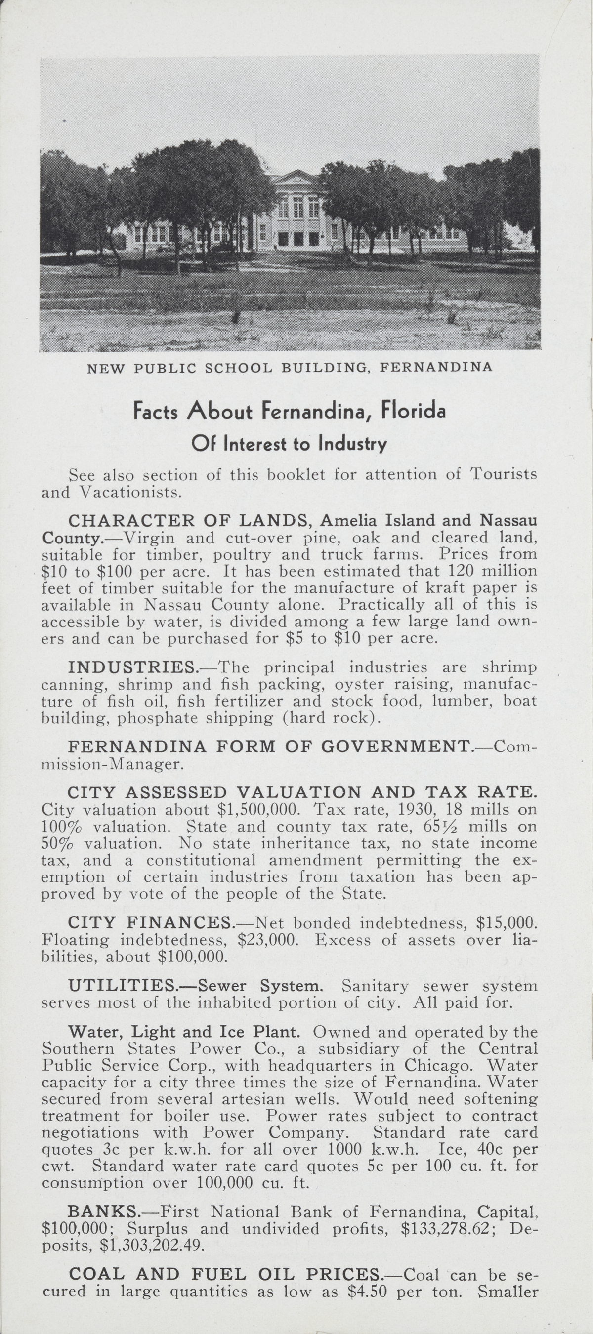
[Photograph of the New Public School Building, Fernandina]
Facts About Fernandina, Florida
Of Interest to Industry
See also section of this booklet for attention of Tourists and Vacationists.
CHARACTER OF LANDS, Amelia Island and Nassau County.— Virgin and cut-over pine, oak and cleared land, suitable for timber, poultry and truck farms. Prices from $10 to $100 per acre. It has been estimated that 120 million feet of timber suitable for the manufacture of kraft paper is available in Nassau County alone. Practically all of this is accessible by water, is divided among a few large land owners and can be purchased for $5 to $10 per acre.
INDUSTRIES.—The principal industries are shrimp canning, shrimp and fish packing, oyster raising, manufacture of fish oil, fish fertilizer and stock food, lumber, boat building, phosphate shipping (hard rock).
FERNANDINA FORM OF GOVERNMENT.—Commission-Manager. :
CITY ASSESSED VALUATION AND TAX RATE. City valuation about $1,500,000. Tax rate, 1930, 18 mills on 100% valuation. State and county tax rate, 65% mills on 50% valuation. No state inheritance tax, no state income tax, and a constitutional amendment permitting the exemption of certain industries from taxation has been approved by vote of the people of the State.
CITY FINANCES.—Net bonded indebtedness, $15,000. Floating indebtedness, $23,000. Excess of assets over liabilities, about $100,000.
UTILITIES.—Sewer System. Sanitary sewer system serves most of the inhabited portion of city. All paid for.
Water, Light and Ice Plant. Owned and operated by the Southern States Power Co., a subsidiary of the Central Public Service Corp., with headquarters in Chicago. Water capacity for a city three times the size of Fernandina. Water secured from several artesian wells. Would need softening treatment for boiler use. Power rates subject to contract negotiations with Power Company. Standard rate card quotes 3c per k.w.h. for all over 1000 k.w.h. Ice, 40c per cwt. Standard water rate card quotes 5c per 100 cu. ft. for consumption over 100,000 cu. ft.
BANKS.—First National Bank of Fernandina, Capital, $100,000; Surplus and undivided profits, $133,278.62; Deposits, $1,303,202.49.
COAL AND FUEL OIL PRICES.—Coal can be secured in large quantities as low as $4.50 per ton. Smaller
[Photograph of a Residence Street, Fernandina]
quantities to $7.00 per ton or higher. Fuel oil can be delivered in large quantities for from 90c to $1.25 per barrel.
WATERFRONT PROPERTY AVAILABLE.—Property of this nature, with 30 ft. of water available at bulkhead line, served by tracks of the Seaboard Air Line Ry. Co. at the rear, accessible by truck, can be purchased or leased at reasonable prices. Cumberland Sound and Amelia River offer a channel of 30 ft. controlling depth to the sea. A ship can dock without the necessity of tug services, 40 minutes after entering the jetties.
Facts About Nassau County
Nassau County, of which Fernandina is the county seat, forms the northeast corner of the State of Florida. It has a population of about 10,000. It has extensive timber and farming areas and the towns of Hilliard and Callahan boast some of the finest poultry farms in the northern part of the State. This section of the county is also widely known for the growing of truck crops, particularly dasheens.
Large quantities of timber yet untouched are available in various parts of the county, while other areas are being planted to slash pine. Cypress, bay, gum, oak, cedar and other varieties offer real possibilities to producers of paper, pulp, etc. Turpentine is one of the staple products of the county. Most of the virgin timber lies on or near the St. Marys River and is accessible by watercraft, railroad and paved highways. Hilliard and Callahan are on the paved highway from Jacksonville to Atlanta via Waycross, Ga. Yulee is at the junction of the paved highway from Jacksonville to Savannah with State Highway No. 13, paved from Yulee to Fernandina, 12 miles away. From Yulee west, State Highway No. 13 is under construction and will eventually form a direct paved connection toward Gainesville and Tallahassee.
Readers of history will be interested in knowing that the paved highway through Callahan and Hilliard is approximately on the route of “the great road from Fort Barrington to St. Augustine, made in 1765, by the subscription of several public spirited gentlemen; among whom were Governors Grant and Moultrie, Messrs. Forbes, Fish, Izard, Pinckney, Gerard, Walton, Manigault, Oswald, Huger, Henry, Laurens, Elliot, Murray, and others, names well known throughout America.” *
* (From Sketches of the Floridas, published in 1821.)
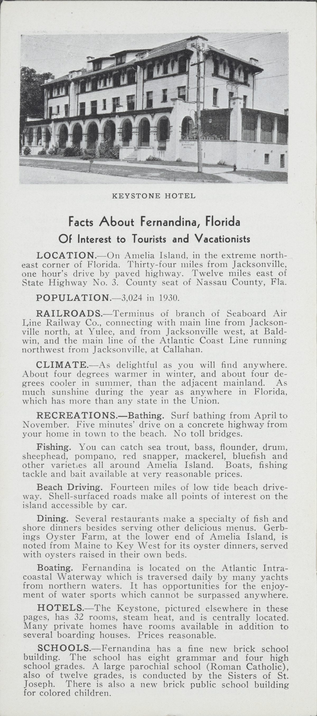
[Photograph of the Keystone Hotel]
Facts About Fernandina, Florida
Of Interest to Tourists and Vacationists
LOCATION.—On Amelia Island, in the extreme northeast corner of Florida. Thirty-four miles from Jacksonville, one hour’s drive by paved highway. Twelve miles east of State Highway No. 3. County seat of Nassau County, Fla.
POPULATION.—3,024 in 1930.
RAILROADS.—Terminus of branch of Seaboard Air Line Railway Co., connecting with main line from Jacksonville north, at Yulee, and from Jacksonville west, at Baldwin, and the main line of the Atlantic Coast Line running northwest from Jacksonville, at Callahan.
CLIMATE.—As delightful as you will find anywhere. About four degrees warmer in winter, and about four degrees cooler in summer, than the adjacent mainland. As much sunshine during the year as anywhere in Florida, which has more than any state in the Union.
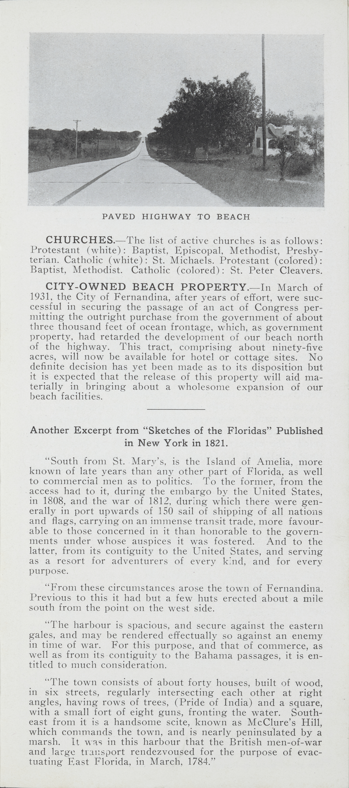
RECREATIONS.—Bathing. Surf bathing from April to November. Five minutes’ drive on a concrete highway from your home in town to the beach. No toll bridges.
Fishing. You can catch sea trout, bass, flounder, drum, sheephead, pompano, red snapper, mackerel, bluefish and other varieties all around Amelia Island. Boats, fishing tackle and bait available at very reasonable prices.
Beach Driving. Fourteen miles of low tide beach driveway. Shell-surfaced roads make all points of interest on the island accessible by car.
Dining. Several restaurants make a specialty of fish and shore dinners besides serving other delicious menus. Gerbings Oyster Farm, at the lower end of Amelia Island, is noted from Maine to Key West for its oyster dinners, served with oysters raised in their own beds.
Boating. Fernandina is located on the Atlantic Intracoastal Waterway which is traversed daily by many yachts from northern waters. It has opportunities for the enjoyment of water sports which cannot be surpassed anywhere.
HOTELS.—The Keystone, pictured elsewhere in these pages, has 32 rooms, steam heat, and is centrally located. Many private homes have rooms available in addition to several boarding houses. Prices reasonable.
SCHOOLS.—Fernandina has a fine new brick school building. The school has eight grammar and four high school grades. A large parochial school (Roman Catholic), also of twelve grades, is conducted by the Sisters of St. Joseph. There is also a new brick public school building for colored children.
[Photograph of the paved highway to beach]
CHURCHES.—The list of active churches is as follows: Protestant (white): Baptist, Episcopal, Methodist, Presbyterian. Catholic (white): St. Michaels. Protestant (colored): Baptist, Methodist. Catholic (colored): St. Peter Cleavers.
CITY-OWNED BEACH PROPERTY.—In March of 1931, the City of Fernandina, after years of effort, were successful in securing the passage of an act of Congress permitting the outright purchase from the government of about three thousand feet of ocean frontage, which, as government property, had retarded the development of our beach north of the highway. This tract, comprising about ninety-five acres, will now be available for hotel or cottage sites. No definite decision has yet been made as to its disposition but it is expected that the release of this property will aid materially in bringing about a wholesome expansion of our beach facilities.
Another Excerpt from “Sketches of the Floridas” Published
in New York in 1821.
“South from St. Marv’s, is the Island of Amelia, more known of late years than any other part of Florida, as well
to commercial men as to politics. To the former, from the access had to it, during the embargo by the United States,
in 1808, and the war of 1812, during which there were generally in port upwards of 150 sail of shipping of all nations and flags, carrying on an immense transit trade, more favourable to those concerned in it than honorable to the governments under whose auspices it was fostered. And to the latter, from its contiguity to the United States, and serving as a resort for adventurers of every kind, and for every purpose.
“From these circumstances arose the town of Fernandina. Previous to this it had but a few huts erected about a mile south from the point on the west side.
“The harbour is spacious, and secure against the eastern gales, and may be rendered effectually so against an enemy in time of war. For this purpose, and that of commerce, as well as from its contiguity to the Bahama passages, it is entitled to much consideration.
“The town consists of about forty houses, built of wood, in six streets, regularly intersecting each other at right angles, having rows of trees, (Pride of India) and a square, with a small fort of eight guns, fronting the water. South- east from it is a handsome scite, known as McClure’s Hill, which commands the town, and is nearly peninsulated by a marsh. [it was in this harbour that the British men-of-war and large transport rendezvoused for the purpose of evactuating East Florida, in March, 1784.”
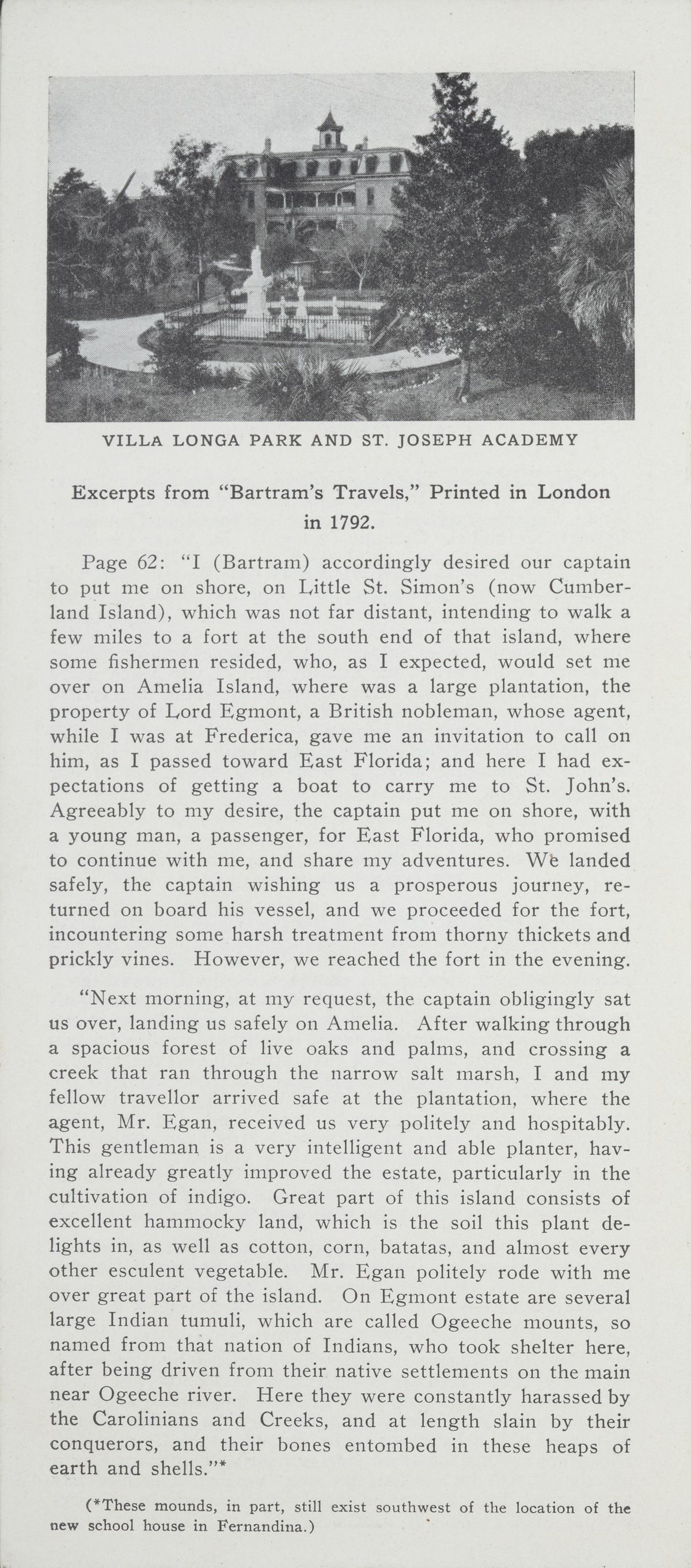
[ Photograph of Villa Long Park and St. Joseph Academy]
Excerpts from “Bartram’s Travels,’ Printed in London
in 1792.
Page 62: “I (Bartram) accordingly desired our captain to put me on shore, on Little St. Simon’s (now Cumber- land Island), which was not far distant, intending to walk a few miles to a fort at the south end of that island, where some fishermen resided, who, as I expected, would set me over on Amelia Island, where was a large plantation, the property of Lord Egmont, a British nobleman, whose agent, while I was at Frederica, gave me an invitation to call on him, as I passed toward East Florida; and here I had expectations of getting a boat to carry me to St. John’s. Agreeably to my desire, the captain put me on shore, with a young man, a passenger, for East Florida, who promised to continue with me, and share my adventures. We landed safely, the captain wishing us a prosperous journey, re- turned on board his vessel, and we proceeded for the fort, incountering some harsh treatment from thorny thickets and prickly vines. However, we reached the fort in the evening.
“Next morning, at my request, the captain obligingly sat us over, landing us safely on Amelia. After walking through
a spacious forest of live oaks and palms, and crossing a creek that ran through the narrow salt marsh, I and my
fellow travellor arrived safe at the plantation, where the agent, Mr. Egan, received us very politely and hospitably. This gentleman is a very intelligent and able planter, having already greatly improved the estate, particularly in the cultivation of indigo. Great part of this island consists of excellent hammocky land, which is the soil this plant de- lights in, as well as cotton, corn, batatas, and almost every other esculent vegetable. Mr. Egan politely rode with me over great part of the island. On Egmont estate are several large Indian tumuli, which are called Ogeeche mounts, so named from that nation of Indians, who took shelter here,
after being driven from their native settlements on the main near Ogeeche river. Here they were constantly harassed by
the Carolinians and Creeks, and at length slain by their conquerors, and their bones entombed in these heaps of earth and shells.’’*
(*These mounds, in part, still exist southwest of the location of the new school house in Fernandina.)
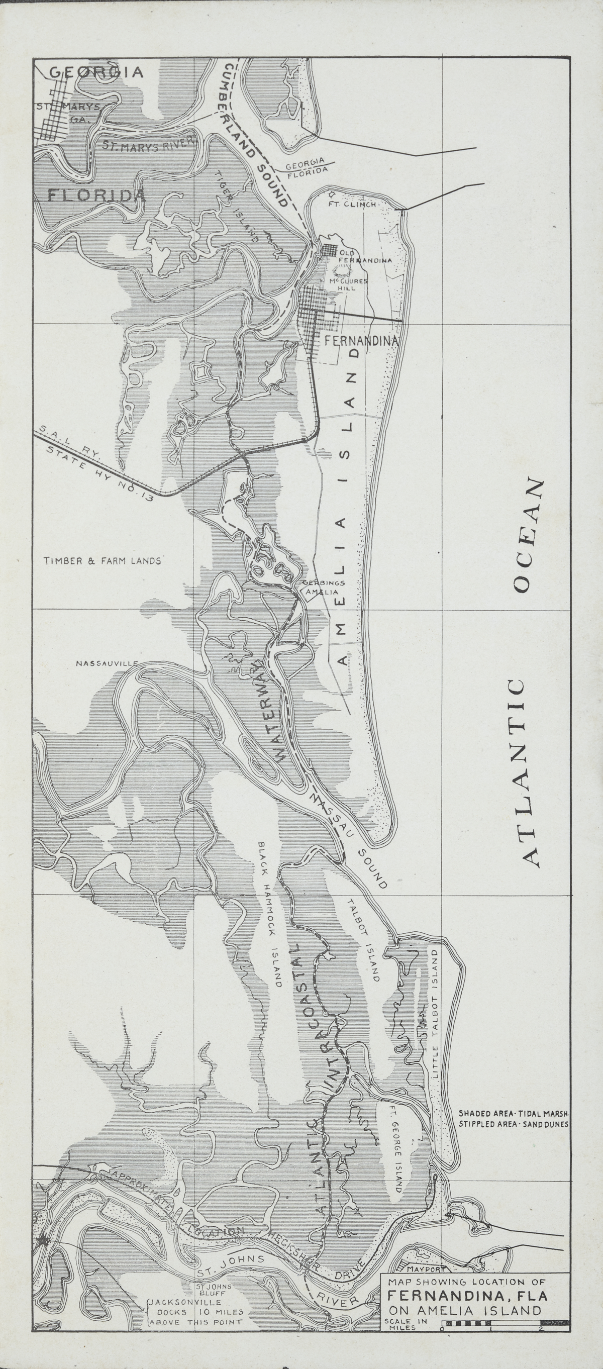
Map Showing Location of Fernandina, Fla On Amelia Island
Back Cover
Fernandina Florida "The Ocean City"
[Drawing of an aerial view of Fernandina]
Chicago Manual of Style
City of Fernandina (Fla.). Brochure promoting Fernandina Florida "The Ocean City," circa 1931. 1931 (circa). State Archives of Florida, Florida Memory. <https://www.floridamemory.com/items/show/351081>, accessed 28 December 2024.
MLA
City of Fernandina (Fla.). Brochure promoting Fernandina Florida "The Ocean City," circa 1931. 1931 (circa). State Archives of Florida, Florida Memory. Accessed 28 Dec. 2024.<https://www.floridamemory.com/items/show/351081>
AP Style Photo Citation
(State Archives of Florida/City of Fernandina (Fla.))

 Listen: The Latin Program