Florida Memory is administered by the Florida Department of State, Division of Library and Information Services, Bureau of Archives and Records Management. The digitized records on Florida Memory come from the collections of the State Archives of Florida and the special collections of the State Library of Florida.

State Archives of Florida
- ArchivesFlorida.com
- State Archives Online Catalog
- ArchivesFlorida.com
- ArchivesFlorida.com
State Library of Florida
Related Sites
Description of previous item
Description of next item
Title
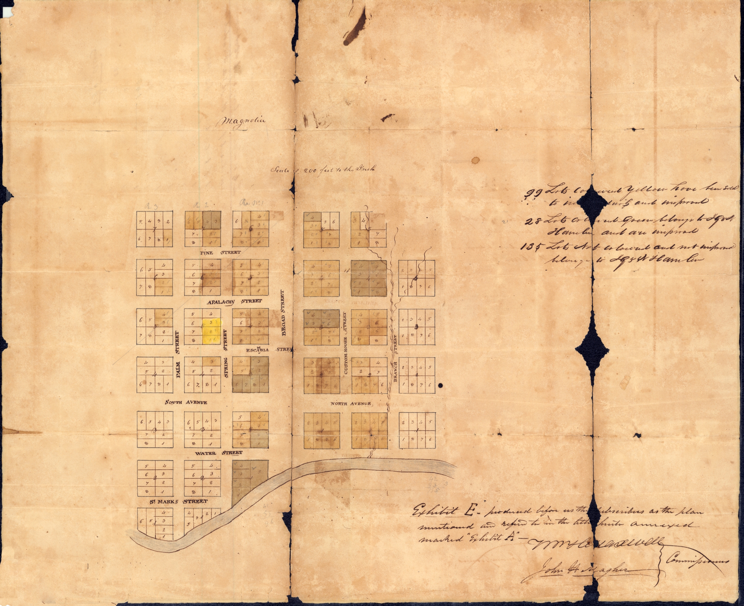
Magnolia and its Vicinity, 1828
Map Number
fmc0132
Source
State Library of Florida, Florida Map Collection, GEOGRAPHIC AREA MAGNOLIA 0001
Date
1828
Publisher
[1828?]
Physical Description
2 maps : back to back, ms., hand-colored; 42 x 51 cm.
Scale
Scale [1:2,400]. "Scale of 200 feet to the inch."
General Notes
Manuscript.
Hand colored.
Exhibit E.
Hand colored.
Exhibit E.
Coverage
Geographic Scope
Format
Counties (1)

Magnolia and its Vicinity, 1828
Order Prints
Please select the size and options
Success: You have added Printed Map to your shopping cart!
How Will it Look?
Title
Magnolia and its Vicinity, 1828
Subject
Real property--Florida--Magnolia--Maps.
Magnolia (Fla.)--Maps, Manuscript.
Source
State Library of Florida, Florida Map Collection, GEOGRAPHIC AREA MAGNOLIA 0001
Publisher
[1828?]
Date
1828
Format
cadastral maps
Language
eng-US
Identifier
fmc0132
Coverage
Territorial Florida (1821-1845)
ImageID
fmc0132
Physical Description
2 maps : back to back, ms., hand-colored; 42 x 51 cm.
General Note
Manuscript.
Hand colored.
Exhibit E.
Scope
Local
County
Wakulla County (Fla.)
Scale
Scale [1:2,400]. "Scale of 200 feet to the inch."
Chicago Manual of Style
Magnolia and its Vicinity, 1828. 1828. State Archives of Florida, Florida Memory. <https://www.floridamemory.com/items/show/323115>, accessed 27 December 2024.
MLA
Magnolia and its Vicinity, 1828. 1828. State Archives of Florida, Florida Memory. Accessed 27 Dec. 2024.<https://www.floridamemory.com/items/show/323115>
AP Style Photo Citation

 Listen: The Blues Program